Montana Growing Zones Explained: What Actually Grows Where You Live
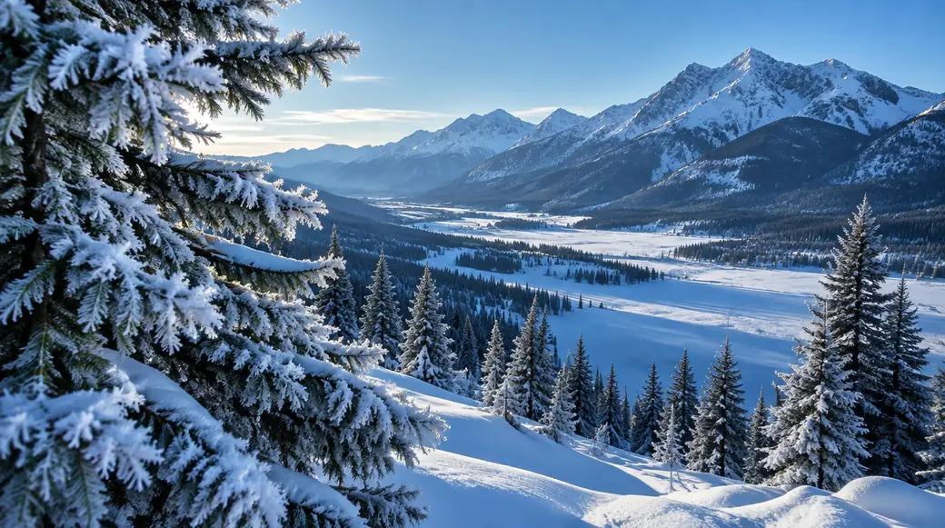
Montana is not one climate. It is at least a dozen, stacked from the floor of the Flathead Valley to the shoulder of the Beartooths, and the distance between those climates is the distance between an apple tree and a dead stick.
So when you typed "Montana growing zone" into a search bar and got back one clean answer, a "4" or a "5," printed like a fact, that answer was wrong. Montana spans eight USDA hardiness zones, from 3a to 6b. Which one you live in depends on where you live, and in some towns on which side of the street you live on.
The 2023 USDA Plant Hardiness Zone Map was the first revision since 2012, and it moved most Montana cities about half a zone warmer than the number many gardeners here still plant by. If you're still using an old zone, you're under-buying. If you're using one number for the whole state, you're guessing.
This page is the long version. Read it once, find your zone properly, and you will stop killing plants that were never going to make it through February.
Montana doesn't have a growing zone. It has eight.
A zone is a minimum winter temperature band.
The USDA hardiness zone system is not complicated once you know what it measures. Zone 3a means the coldest nights of a typical winter bottom out around −40°F. Zone 6b means the coldest nights hold around 0 to −5°F. That is the whole idea: which plants can survive your worst night, not your average one.
Across Montana, that range is enormous:
- Zone 3a: the coldest pockets in the high country, near −40°F.
- Zone 6b: the warmest shorelines of Flathead Lake, near 0°F.
Forty degrees of difference in the coldest night of the year.
Set a zone 6b plant in a zone 3a yard and it doesn't get "stressed." It dies, usually in its first January, and usually after you've watered it all summer.
Almost everyone makes the same mistake here. You take a state-level number, "Montana is zone 4," and you plant to it. Montana is zone 4 somewhere. It is also zone 3a somewhere and 6b somewhere. The state doesn't have a zone. Your yard does.
And that matters most for the plants you can't easily replace, the trees and shrubs you'll look at for thirty years. A misplaced tomato costs you a season. A misplaced tree costs you a decade.
What the 2023 USDA map changed — and why your old zone is wrong
For more than a decade, the reference everyone used was the 2012 map. It was a good map. It is now outdated.
The 2023 USDA Plant Hardiness Zone Map, built by the U.S. Department of Agriculture with data from Oregon State University's PRISM Climate Group, was the first update in eleven years. Across Montana it nudged most cities roughly half a zone warmer. A town once labeled 4a may now be 4b; a spot once 5a may now read 5b.
Half a zone sounds trivial. It isn't. Half a zone is the difference between a plant that survives your winters and one that survives most of them, and there is no such thing as surviving most winters. A shrub that dies in year three is a shrub you planted twice.
Two things to understand about the shift, because people misread it in both directions:
- Warmer zones do not mean "anything goes now." The map measures minimum winter temperature. It says nothing about how long your growing season is, how much it rains, how windy it gets, or how many times you get hailstones the size of marbles. A warmer zone with a shorter season is still a short season.
- The half-zone shift is real, but it is not a license to gamble. Plant one zone band colder than your official number and you will sleep better every winter. That habit, planting a zone conservative, is the single best insurance a Montana gardener can buy.
The practical takeaway: if you learned your zone before 2023, look it up again. You're probably in a warmer band than you think, and you're probably still planting to the old one. Confirm your current number at the official tool before you buy anything. There's more on that below.
Every Montana growing zone, city by city
This is how the numbers actually fall across the state. Use it as a starting map, then verify your exact spot at the USDA tool, because a city can straddle two zones and this table rounds to the dominant one.
| City | Zone | Elevation (ft) |
|---|---|---|
| Billings | 5a (straddles 5a/5b) | 3,153 |
| Missoula | 5b (straddles 5b/6a) | 3,198 |
| Bozeman | 4b (straddles 4b/5a) | 4,806 |
| Great Falls | 4b | 3,398 |
| Kalispell | 5b | 2,984 |
| Helena | 4b–5a | 4,068 |
| Butte | 4a–5a | 5,539 |
| Belgrade | 4b | 4,452 |
| Whitefish | 5a–5b | 2,998 |
| Livingston | 5a | 4,557 |
| Hamilton | 5b–6a | 3,625 |
| Polson | 5b–6a | 2,930 |
| Columbia Falls | 5a–5b | 3,002 |
| Havre | 4a | 2,493 |
| Miles City | 4a–4b | 2,362 |
| Sidney | 4a | 1,967 |
| Glendive | 4a | 2,053 |
| Lewistown | 4b | 3,936 |
| Red Lodge | 5a | 5,562 |
Sources: zone bands from the 2023 USDA Plant Hardiness Zone Map (planthardiness.ars.usda.gov); elevations are town-center figures. Frost-free-day counts cited on this page are approximate single-station estimates, not official USDA values.
Read that table slowly, because something in it should look strange. Butte, at 5,539 feet, sits in roughly the same zone as Sidney, at 1,967 feet, nearly 3,600 feet lower. If latitude or elevation alone set your zone, that couldn't happen. Something else is doing the work.
Two notes before you use any of this:
- Where a cell shows a range, you genuinely straddle two zones. Butte is the clearest example; published sources disagree on whether the town core reads 4a or 5a. When you straddle, plant to the colder number.
- The italic caveat. Confirm every one of these at the official USDA tool at planthardiness.ars.usda.gov. Zones are fine-grained, they follow terrain as much as towns, and a single city can span two bands. This table is a starting point, not a verdict on your yard.
Elevation, not latitude, is what actually drives your season
Now for the idea this whole page is built around. It is the one that explains everything else, and the one almost no Montana gardening page tells you plainly.
Your growing season is set by elevation and terrain, not by how far north you are.
Everyone assumes north means cold. In Montana, that's backwards. Look at two towns:
- Red Lodge sits at about 45.2° north, nearly the same latitude as Bozeman, well south of the Canadian border, at 5,562 feet. It has one of the shortest growing seasons of any major Montana town, about 116 frost-free days, though Butte, higher and colder, is shorter still.
- Havre sits at about 48.5° north, roughly 230 miles closer to Canada, at 2,493 feet. It has a longer growing season, about 136 frost-free days.
Havre is more than three degrees of latitude north of Red Lodge, and it still gets roughly twenty more frost-free days to work with, and the reason is the thing this whole page keeps circling back to: the ground you stand on sets your season, not the line of latitude you stand on, and on that measure a town hundreds of miles closer to the Canadian border wins outright.
Latitude loses. Elevation wins.
Why? Temperature falls with altitude, fast, roughly three to five degrees Fahrenheit for every 1,000 feet you climb. Red Lodge is more than 3,000 feet above Havre. That altitude penalty swamps the latitude advantage, and Red Lodge ends up with the harsher, shorter season despite sitting farther south.
This is why the state's coldest gardens aren't in the north. They're in the mountains and the high valleys, wherever the ground sits above about 5,000 feet:
- Butte, 5,539 ft: the shortest season in this table, about 92 frost-free days.
- Red Lodge, 5,562 ft: about 116 days.
- Bozeman, 4,806 ft: about 126 days.
- Livingston, 4,557 ft: about 116 days.
And it's why some of the longest seasons sit well north:
- Polson, 2,930 ft: about 155 frost-free days.
- Havre, 2,493 ft: about 136 days.
Same state. Same growing zone bands in places. Almost a 65-day spread in how long you have to grow a tomato. That spread is elevation doing the talking, and it's why "Montana's growing season" is not a real unit of measure.
We go deeper into the season lengths and how to use them on our page on Montana frost dates by city, and once you know your dates, when to plant in Montana is where you turn those numbers into a calendar.
Zones vs. frost-free days vs. microclimates — three things people confuse
Three different numbers get used as if they were one, and they are not:
1. Hardiness zone = how cold it gets. This is the USDA number. It tells you the coldest night you should expect and therefore which perennial plants can survive your winter. Zone 4b means the coldest nights land near −25 to −20°F. It says nothing about summer.
2. Frost-free days = how long you get to grow. This is the count of days between your last spring frost and your first fall frost. It tells you how much time you have for an annual crop, tomatoes, squash, beans. A zone 4b town with 126 frost-free days and a zone 4b town with 100 frost-free days both have the same winter. They have very different summers.
3. Microclimate = the pocket you actually garden in. This is the local exception: the south-facing slope, the lakeshore, the sheltered courtyard, the frost pocket. It can move your real growing conditions by a full zone or by weeks of frost, in either direction.
A plant has to pass all three tests:
- Does it survive your zone, meaning winter cold?
- Does it finish in your frost-free days, meaning summer length?
- Will it sit in a good or bad microclimate on your property?
Miss any one and the plant fails. The zonal geranium that thrives all summer dies at first frost. It passed the season test. It failed the winter test. The peach tree that's rated for your zone but sits in a valley-bottom frost pocket passes the zone test. It fails the microclimate test. Most "I don't know why it died" stories in Montana are one of these two mismatches. Bad luck is rarely the reason. The plant was simply asked to do something it couldn't do.
The two numbers also explain why "just plant cold-hardy things" is incomplete advice. Cold-hardiness and season length are independent. A plant can be perfectly winter-hardy and still never ripen here, because it needs 150 days and you have 116. That's the trap our best trees for Montana guide is built to keep you out of.
The microclimates that beat your zone
Your zone is an average over a whole region. Your yard is a specific piece of ground, and terrain makes it warmer or colder than the map says. In Montana, these are the effects that matter most, and learning to read them is how you grow things that "shouldn't" grow here.
South-facing slopes are the warmest ground you own. A slope facing south collects more sun, warms earlier in spring, melts its snow sooner, and ripens fruit better. It is the classic site for a fruit tree in this state. If you have one, use it. If your only open ground faces north, you have a colder garden than your neighbors down the street, and you should plant accordingly.
Valley bottoms are colder than the slopes just above them. This is the inversion trap. Cold, dense air drains downhill at night and pools on the valley floor, so the lowest ground is the coldest ground, not the warmest, and Missoula is the textbook inversion valley in Montana, and the flat spot by the creek that looks like the nicest garden site is often the frost pocket that kills it. The practical rule that follows is one of the most useful in this entire state: plant frost-sensitive stock partway up a slope, not at the bottom. Push a screwdriver into the ground on a March morning and you can feel which side of your own yard is still locked up.
Thermal belts are the warm band above the inversion. Just above where cold air pools, there's a mid-slope band that stays warmer all winter than either the valley floor below it or the exposed ridge above it. Montana's historic orchards and tender ornamentals were sited here for exactly this reason. When the Bitterroot and Mission valley fruit growers picked their ground, they were reading the thermal belt. You can read it too.
Flathead Lake moderates everything on its shore, and it holds the state's warmest classifications. The shoreline communities around Flathead Lake, Polson, Lakeside, Big Arm, Finley Point, Rollins, run zone 5b to 6b, warmer than the surrounding valley only a few miles inland. Big Arm, Finley Point, and Belknap reach 6b, the warmest classification anywhere in Montana. Polson also records the latest average first fall frost of any of the state's major cities. That is why the Flathead's lakeshore can grow things the rest of Montana can only envy. Water is a heat battery: it warms slowly, cools slowly, and hands that stored warmth back to the shore all autumn.
Urban heat makes cities warmer than the plains around them. Pavement, buildings, and reduced wind keep towns a touch warmer than open country nearby. It rarely changes your zone band, but it can buy you a little margin on frost, another reason a garden in town may not match a garden ten miles out.
Windbreaks change your microclimate more than almost anything you can build. A well-placed shelterbelt reduces wind, cuts winter desiccation, traps snow where you want it, and raises soil temperature on the sheltered side. In a state where drying winter wind does more damage than cold alone, a windbreak is often the highest-return thing you can plant. We cover the mechanics of that damage on our page on winter desiccation in Montana, and it's worth reading before your first January.
Put together, microclimates are the reason two gardens in the same town, same zone, same frost dates can look completely different. Yours is not the town's climate. It is the climate of one slope, one shelterbelt, one patch of ground.
How to find YOUR zone — and why a city can straddle two
Here is the practical procedure. It takes ten minutes and it will save you hundreds of dollars in plants that were never going to live.
- Start with the table above to find your nearest city's band. Treat it as "roughly where you are."
- Go to the official USDA tool at planthardiness.ars.usda.gov and enter your ZIP code. Then zoom in. The map is fine-grained, it follows terrain, not town boundaries. You want the color of the pixel your yard sits on, not the label over the town.
- Adjust for your specific ground. Are you in a valley bottom, which runs colder? On a south slope, or a lakeshore, which run warmer? Above 5,000 feet, which runs colder? Nudge accordingly, and when in doubt, round down a half band.
- Plant one zone conservative. Whatever number you land on, buy plants rated one zone colder. That margin is the difference between a landscape you rebuild every few years and one that fills in and gets better. If you'd rather start from a list, the species in our native plants of Montana guide were rated for Montana's own zone bands.
Why the insistence on straddling? Because it's real. Billings straddles 5a and 5b. Missoula straddles 5b and 6a. Bozeman straddles 4b and 5a. Hamilton and Polson straddle 5b and 6a. If you live in one of these towns, the map's single label is a coin-flip over where your actual yard sits. The town has two answers. Your ground has one.
That fine grain is also why the aggregator sites you'll find in search results disagree with each other, and with the USDA.
They're averaging. You're not gardening an average.
The USDA tool caveat — read this before you trust any zone number
One honest limitation, because a page about zones that doesn't mention it isn't doing its job:
The USDA hardiness map is a model, and an average. It's built from decades of weather data interpolated across terrain, and it tells you the typical coldest night for an area roughly the size of a neighborhood. It is the best standard we have, and it's what this page, and every reputable plant label and nursery, is built on.
But it has real limits you should know:
- It measures winter cold only. It does not measure growing-season length, precipitation, wind, hail, or soil. A zone number is one input, not a verdict. The growing regions of Montana are defined by all of those together.
- It's a regional average, not an address. A city can straddle two bands, and the interpolated line can fall in a place that surprises you. Verify with the tool, then trust your own ground.
- It won't predict an outlier winter. Zones describe minimums that recur on a cycle of decades. A single brutal January can drop below your band and kill things that are "supposed" to be fine. This is the argument for planting a zone conservative.
- For the record: Montana's zones are published across a range of sources that don't always agree. Butte is the standout, where sources split between 4a and 5a. That split is why we publish it as a range. When sources disagree, plant to the colder number and you'll never be the one surprised.
Use the map as your foundation. Then correct it for your slope, your elevation, and your shelter. That combination, the official number plus your specific ground, is the zone that actually matters.
Frequently asked questions
What zone is Montana in for gardening?
Montana spans zones 3a through 6b, eight different hardiness zones, not one. The coldest high-country pockets are 3a, near −40°F, and the warmest Flathead Lake shorelines reach 6b, near 0°F. There is no single "Montana zone." Your zone depends on where in the state, and often where on the hill, you live.
Why did Montana's growing zones change?
The 2023 USDA Plant Hardiness Zone Map was the first update since 2012, and it moved most Montana cities about half a zone warmer. If you learned your zone before 2023, you're likely in a warmer band now than the number you're planting by. Confirm the current value at the USDA tool.
Is Montana a zone 4 or zone 5?
Both, and more. Cities like Great Falls (4b), Bozeman (4b), and Havre (4a) sit in zone 4 bands. Missoula (5b), Kalispell (5b), and Billings (5a) sit in zone 5 bands. Hamilton and Polson reach zone 5b–6a. The number follows your ground, not the state.
Does elevation or latitude determine my growing zone in Montana?
Elevation and terrain dominate. Red Lodge (5,562 ft) has a shorter season than Havre (2,493 ft) despite sitting farther south, about 116 frost-free days versus 136. Havre is roughly 230 miles closer to Canada and still has three more weeks to grow. Temperature drops about three to five degrees per 1,000 feet of elevation, and that outweighs latitude.
How do I find my exact USDA hardiness zone?
Enter your ZIP code at the official tool, planthardiness.ars.usda.gov, then zoom in far enough to read the ground under your yard, not just your town. Adjust for your slope, elevation, and shelter, and plant one zone colder than the number you land on. Big cities like Bozeman, Billings, and Missoula straddle two bands, so the extra precision is worth it.
Can my yard be warmer or colder than my town's zone?
Yes, routinely. A south-facing slope, a lakeshore, or a windbreak-protected courtyard can run a full half-zone warmer than the town average. A valley bottom, an exposed north slope, or high ground can run colder. Your zone is the zone of the ground you stand on.
Your zone is a starting line, not a finish line
The reason a single number can't answer "what grows here" is that Montana asks every plant to pass more tests than winter cold. Your zone tells you which perennials survive your worst night. Your frost-free days tell you how long an annual has to finish. Your microclimate tells you whether your specific ground is warmer or colder than the map's average. Get all three right and this state stops being "too harsh to garden" and starts being a place where the right plant thrives precisely because you chose it for the right ground. So don't trust a state number, and don't trust an old one. Look up your zone at the official tool, adjust for your slope, and plant a half-zone conservative. And if you're not sure what will grow where you are, or which of Montana's wildly different valleys you're actually gardening in, start by finding your Montana growing region.
Not sure what will grow where you are? Find your Montana growing region.

